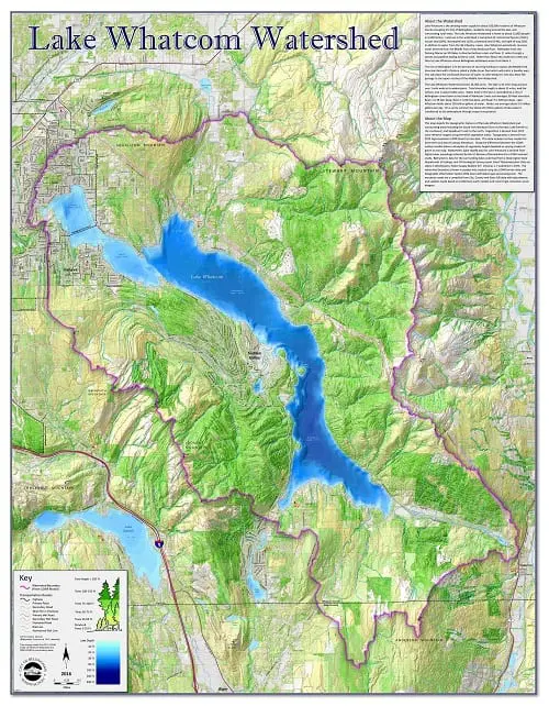
Illustrates the topographic relief, forest cover, and bathymetry of the Lake Whatcom Watershed. Includes watershed boundaries, lakes, streams, paved roads, mountain roads, and orphaned roads.
Lake Whatcom Topographical Map (7MB PDF)
Paper copies of the Map Gallery maps can be purchased from the Planning Department for the following prices (additional sizes and prices are available for select maps):
18″ x 24″ Maps are $10.00
27″ x 36″ Maps are $16.00
36″ x 48″ Maps are $21.00
Local pick-ups only – no mail outs.
