The Preserve America Program awarded 43 grants in 2007 totaling nearly $2.6 million. Bellingham was awarded $150,000, the maximum granted to Preserve America recipients. The federal grant program provides funds on a matching basis to assist Preserve America Communities with marketing, planning and educational efforts associated with protection and utilization of community heritage assets. For more information visit the Preserve America website at http://www.preserveamerica.gov/.
As part of this grant the City of Bellingham worked with neighbors, students and other volunteers to conduct an historic resource survey and inventory of three of it’s older neighborhoods: Lettered Streets, York, and South Hill. These neighborhoods were selected for the project because they were able to demonstrate neighborhood-wide commitment to the project, collectively pledged 3000 hours in volunteer match, had organized neighborhood historic preservation committees and were actively seeking preservation assistance from the City. Additionally, the project advances long-standing neighborhood revitalization goals for the Lettered Streets and York Neighborhoods, two of the City’s Community Development Block Grant Target Neighborhoods.
Identifying cultural and historic resources was the first step toward understanding the architectural, social and historical significance of a place, and is instrumental in defining neighborhood character. Neighborhood volunteers and Western Washington University students worked with consultants from Historic Preservation Northwest (HPNW) to learn how to complete historical research, describe architectural style and write statements of significance for buildings over 50 years old. As part of the survey, buildings and other historic resources constructed before 1960 have been photographed, documented and researched to reveal their history, architectural style and character-defining features. Information and photos from the survey are being incorporated into the City’s Geographic Information System (GIS) so they can be used by the neighborhoods for mapping, planning, illustration and interpretation.
Background Data
The maps, images and graphs were all created with the City’s Geographic Information System (GIS) using the information gathered by the consultants, volunteers, and students as part of the Historic Resource Survey. GIS allows us to assign a spatial element to data and makes it possible for information to be plotted on a map. Once the information is entered into GIS, different maps, charts and other graphics can easily be created. These maps and graphics will enable the neighborhoods to quickly view the information and analyze patterns that exist in their neighborhoods.
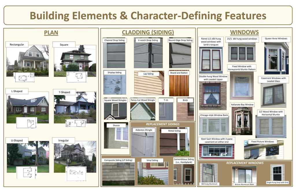
Below are a few examples of common features, elements, and styles found in all three neighborhoods.

Building Elements and Character-Defining Features
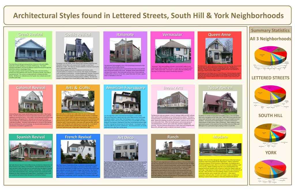
Architectural Styles & Summary Statistics

