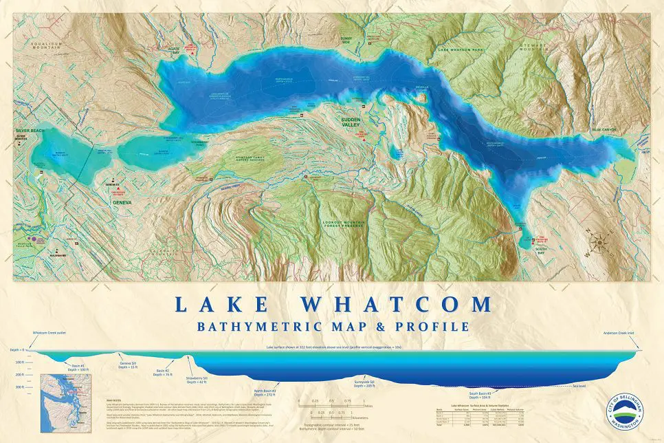
Illustrates the topography of Lake Whatcom both above and below the water surface. Includes cross-sectional profile of lake depths for the 3 primary basins. This map is available for purchase through the Planning department in the three sizes listed below.
Lake Whatcom Bathymetric Map (5.4MB PDF)
Paper copies of the Bathymetric Map can be purchased from the Planning Department. The sizes and prices for printed copies of this map are different from the standard offered for other maps. The prices for this map are below:
18″ x 27″ Maps are $12.00
24″ x 36″ Maps are $16.00
36″ x 54″ Maps are $27.00
Local pick-ups only – no mailouts.
