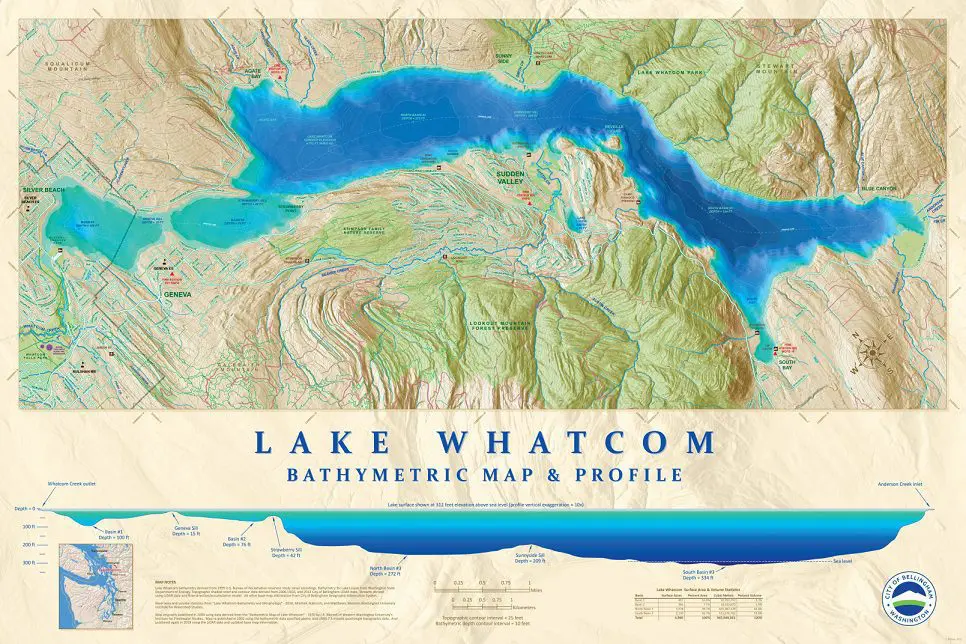
Illustrates the topography of Lake Whatcom both above and below the water surface. Includes cross-sectional profile of lake depths for the 3 primary basins. This map is available for purchase through the Planning department in the three sizes listed below.
Lake Whatcom Bathymetric Map (5.4MB PDF)
All maps provided on this site are public domain and are free to be printed at home or by any print shop. At this time, we do not offer printing services.
