Survey Data and Information

​​​​​​​The City of Bellingham’s Real Property Group coordinates professional survey services for the Public Works Department and other City departments. We collect and maintain survey records and data to support the Public Works Capital Improvement Program and GIS utility mapping as well as to provide information to City departments and the community. We also maintain an inventory of Public Land Survey System (PLSS) corners, right-of-way monuments, and horizontal and vertical control as part of the City Survey Control Database.

Survey Monuments

The City’s right-of-way and reference monuments are the backbone of our entire infrastructure. Monuments help us establish the limits of public right-of-way, private ownership, and public and private easements. Monuments are used to determine the location of our entire infrastructure, for construction, and for placement of new utilities.

All monuments are inspected and recorded by the professional surveyors in the City’s Real Property Group. Information on survey monuments can be found using the Survey Monument Lookup Tool.

Please contact us at landsurveyinfo@cob.org if you think you might disturb a survey monument.

A survey monument can control the location of private or public property lines. Many monuments are referred to in property deeds and unless protected, could result in unnecessary costs. It is important to be able to identify and protect survey monuments.

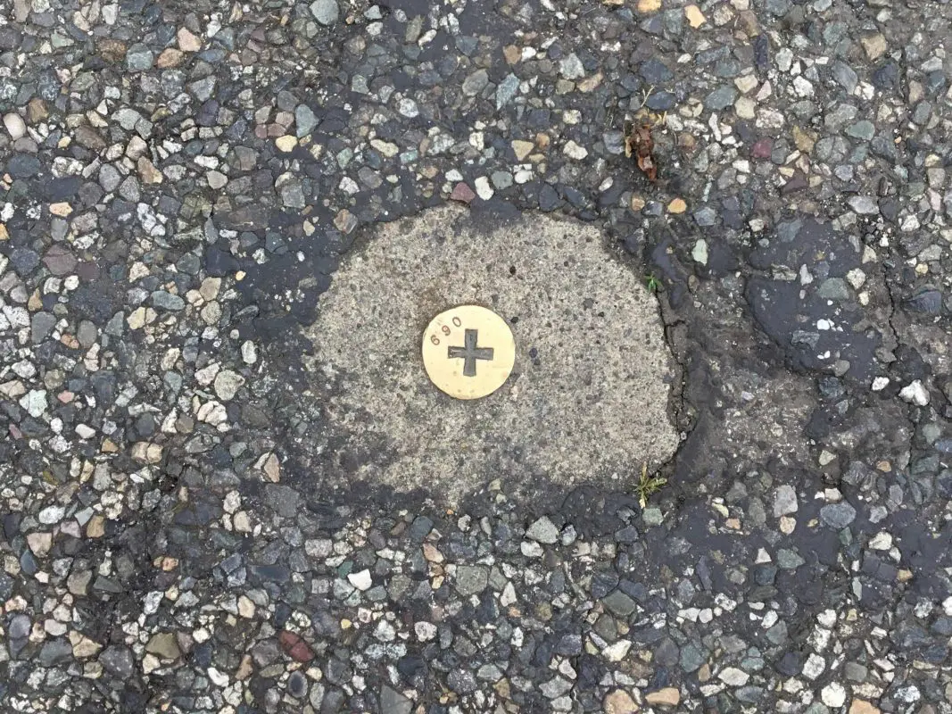
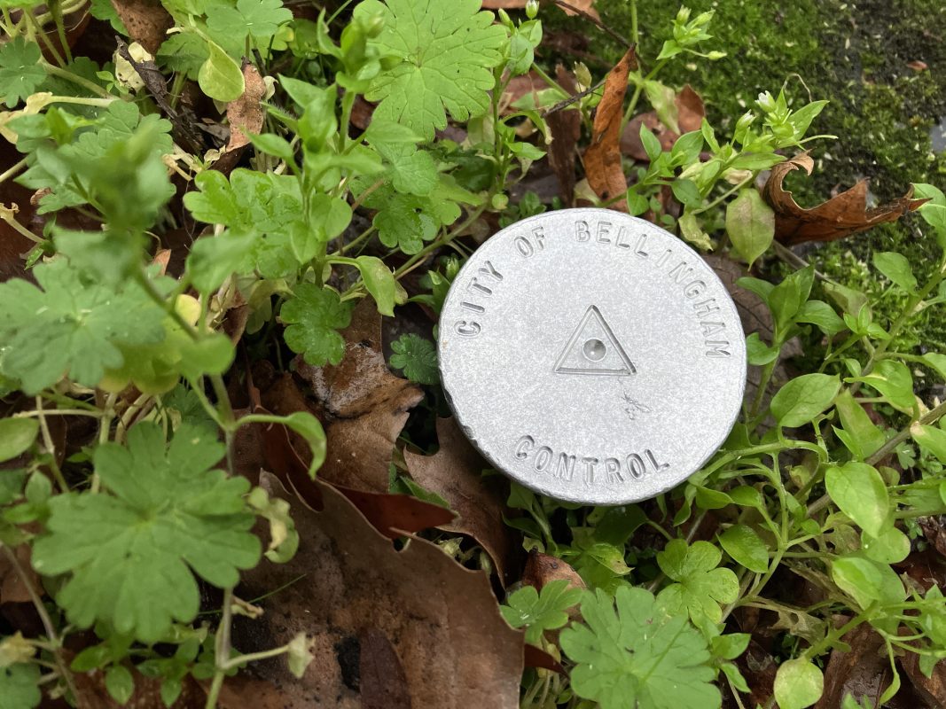
Monuments can be either a natural material or manmade, and a variety of sizes. A monument can range from a small tack in concrete to a large boulder, a 150-year-old Douglas Fir tree, or the center of a creek. Below are some examples of survey monuments in Bellingham:

Monuments are not always located on the center of a right-of-way or on a right-of-way/property line. Survey control monuments can be found anywhere in the right-of-way and occasionally on private property. The City of Bellingham’s survey staff use a variety of survey applications and databases to locate monuments that are buried or difficult to see. You can find a map of existing survey monuments with the Survey Monument Lookup Tool.

Many monuments are stamped with the land surveyor’s certificate number. A list of certificate numbers for Professional Land Surveyors can be acquired from the Washington State Department of Licensing.

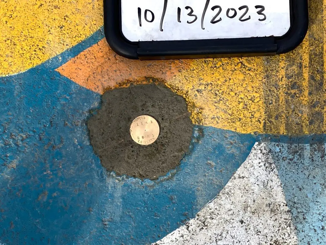
Very small metallic circle in the middle of a colorful mural. The circle says COB 2023 on it.
This monument is stamped with a monument ID number, the year the monument was set, and the land surveyor’s certificate number.

A permit is required to remove or destroy a survey monument. For more information, contact the Washington State Department of Natural Resources. Please also contact the City of Bellingham at landsurveyinfo@cob.org if you think you might disturb a survey monument.

What is monument destruction?

According to WAC 332-120-020, removal or destruction of a monument is defined as: the physical disturbance of a monument such that the physical structure no longer marks the location of the land boundary position.

Who is responsible for protecting monuments?

According to WAC 332-120-030:

  1. No survey monument shall be removed or destroyed before a permit is obtained as required by this chapter.
  2. Any person, corporation, association, department, or subdivision of the state, county or municipality responsible for an activity that may cause a survey monument to be removed or destroyed shall be responsible for ensuring that the original survey point is perpetuated. It shall be the responsibility of the governmental agency or others performing construction work or other activity (including road or street resurfacing projects) to adequately search the records and the physical area of the proposed construction work or other activity for the purpose of locating and referencing any known or existing survey monuments.

What about monuments disturbed by construction activities?

According to RCW 58.09.130:

When adequate records exist as to the location of subdivision, tract, street, or highway monuments, such monuments shall be located and referenced by or under the direction of a land surveyor at the time when streets or highways are reconstructed or relocated, or when other construction or activity affects their perpetuation. Whenever practical a suitable monument shall be reset in the surface of the new construction. In all other cases permanent witness monuments shall be set to perpetuate the location of preexisting monuments. Additionally, sufficient controlling monuments shall be retained or replaced in their original positions to enable land lines, property corners, elevations and tract boundaries to be reestablished without requiring surveys originating from monuments other than the ones disturbed by the current construction or activity.

It shall be the responsibility of the governmental agency or others performing construction work or other activity to provide for the monumentation required by this section. It shall be the duty of every land surveyor to cooperate with such governmental agency or other person in matters of maps, field notes, and other pertinent records. Monuments set to mark the limiting lines of highways, roads, or streets shall not be deemed adequate for this purpose unless specifically noted on the records of the improvement works with direct ties in bearing or azimuth and distance between those and other monuments of record. [1973 c 50 § 13.]

Have you found that a monument is unlisted, damaged, destroyed, or different than reported?

If so, please fill out this online City of Bellingham Survey Monument Recovery Report Form.

Resources

Contact

Please email us at landsurveyinfo@cob.org with questions.